All Tours: 54
Tours
Meet Me at the Crossroads: The Life and Legend of Marie Laveau
4 Locations ~ Curated by August Darbonne
Marie Laveau is known to many as the Vodou Queen of New Orleans. Vodou is an Afro-syncretic religion, blending elements of West and Central African religion, Native American spirituality, and European Catholicism. In the 18th and 19th centuries, when enslavers trafficked West African peoples to the Americas, they banned enslaved people from practicing their traditional religions. In order to continue to practice their traditional religion, while avoiding punishment or death from French and…
The City Beneath the City: Archaeology of New Orleans
27 Locations ~ Curated by University of New Orleans, Department of Anthropology and Sociology
This tour includes information about archaeological sites already investigated in Orleans Parish. Some of these sites are now destroyed. Others are no longer accessible or have considerable untapped research potential. Most are on private property and not readily accessible to the public.
As there are few protections for archaeological resources in the city, the locations of some of these projects are only approximate. We ask that you do your part to help us preserve and protect the cultural…
Animals in the French Quarter
4 Locations ~ Curated by Alison Laurence, Sarah Waits, John Lee, and the University of New Orleans History Department
This tour examines the significant ways in which animals have affected the lives of New Orleanians. Within the confines of the French Quarter, rats, mules, mosquitoes, termites, and other critters cohabitate with the human residents.
Access: Walking
Distance: ~.5 miles, ~10 minutes
Lake Catherine & The Rigolets
6 Locations ~ Curated by Charlotte Dover, Virgil Dover, and the University of New Orleans History Department
The Rigolets is an area of New Orleans East that has played a vital part in New Orleans history. Maroon communities developed in the area during the colonial period and forts were later built to protect the city. Most of what made this area distinctive washed away, but there are a few remains of this historically integral part of the city. This tour explores restored sites as well as a few that only exist as photographs and memories.
The tour begins at Fort Macomb, which is located near the…
New Orleans Lakefront
8 Locations ~ Curated by Patrick Stephen
An exploration of some of the historical locations and uses of New Orleans' lakefront, including colonial fortifications, military bases, amusement parks, and the University of New Orleans.
Access: Biking
Distance: ~7 miles, ~30 minutes - 1 hour via Lakeshore Drive and Canal Boulevard (excludes Lincoln Beach).
Tips: Lincoln Beach is closed to the public at this time. There is also no good bike route to reach it along this tour.
Battle of Liberty Place
4 Locations ~ Curated by Gordon Chadwick
On September 14, 1874, what became known as the Battle of Liberty Place was fought between militant conservative Democrats known as the White League and Federalist forces led by the Municipal Police.
As historian Justin Nystrom has written, the event effectively brought an end of Reconstruction policies in Louisiana. After the contested gubernatorial election of 1872, in which Democratic-Conservative John McEnery was defeated by the Republican ticket headed by US Senator William Pitt…
City Park
12 Locations ~ Curated by Kimberly Jochum, Amanda Knight, and University of New Orleans History Department
City Park is a massive green space stretching from the Mid- City neighborhood nearly to Lake Pontchartrain. Only a fraction of City Park's 1300 acres will be accessed on this tour that highlights important sites and monuments while giving context for the spaces and ground you are walking through. Travel from the earliest documented origns of the park through the contemporary removal of a Confederate monument.
Access: Walking
Distance: ~0.5 miles, ~15 minutes
Newcomb College Broadway Campus
11 Locations ~ Curated by Newcomb College Institute
Newcomb College is a women’s college established within Tulane University in 1886. Explore the present Broadway campus, the last of three locations that have housed the noted school. Discover its history, characters, and legacy, and understand how it maintains its own identity in the present with its longstanding association with Tulane University.
Access: Walking
Distance: ~1 mile, ~30 minutes
Bayou St. John
6 Locations ~ Curated by Amanda Knight
Bayou St. John is a slow-moving waterway that flows into Lake Pontchartrain. Today, it winds through several neighborhoods and forms a boundary for one side of City Park on its journey to the lake.
Before and during French colonization, Indigenous people used the bayou as a shortcut to navigate between the Gulf of Mexico and the Mississippi River, taking advantage of the place where the river and Bayou St. John were closest together. They portaged their boats between the waterways, carrying…
1884 Cotton Centennial Exposition in Audubon Park
9 Locations ~ Curated by Miki Pfeffer and the University of New Orleans History Department
Take an imaginative journey through a nineteenth-century World’s Fair. Only the beauty of the grounds exists today, for expositions were fleeting spectacles. Yet, photographic "ghost" images recall a time when the world’s products, accomplishments, and dreams were spread before eager travelers to New Orleans.
Access: Walking or biking
Distance: ~2.5 miles, ~1 hour
"Old Newcomb": The First Two Newcomb College Campuses
13 Locations ~ Curated by Newcomb College Institute
Explore the original DeLord and Camp Street campus, as well as the second campus of Newcomb College, located on Washington Avenue. Uncover the history, characters, and legacy that shaped Newcomb College into what it is today by following its expansion from 1887 to 1918, when the college moved to its present-day campus on Broadway.
Access: Walking
Distance: ~.5 miles, ~10 minutes
Tips: If you are planning to walk this route, be aware that while most stops are near each other, stops one…
Levee Breaches During Katrina
4 Locations ~ Curated by Levees.org, New Orleans Public Library, Louisiana State Museum, and the University of New Orleans History Department
Both residents and visitors to New Orleans still have the desire to see where the levees failed during Katrina in August 2005. This tour includes the sites of the Southeast breach of the Industrial Canal, which flooded the Lower Ninth Ward, the East breach of the London Avenue Canal, which flooded Gentilly, and the 17th Street Canal breach, which flooded Lakeview.
In 2005, Sandy Rosenthal founded levees.org with her son Stanford, then just 15 years old, to raise awareness about why the…
Bridging Lake Pontchartrain
4 Locations ~ Curated by Graham Cooper & University of New Orleans History Department
The bridging of St. Tammany Parish and Orleans Parishes had been an issue of public interest from before the age of the automobile. Rail and ferry crossings of the lake were already well established by the time automobile bridges were contemplated in the 1910s. A great deal of public interest and propaganda developed regarding the earliest proposals of an auto bridge across Lake Pontchartrain or adjoining waters.
Access: Driving
Distance: ~50 miles, ~1-1.5 hours.
O-K Rail Line, Kenner to New Orleans
4 Locations ~ Curated by Jeremy Deubler & University of New Orleans History Department
The Orleans-Kenner Traction Company connected downtown New Orleans to Kenner from 1915 to 1930. The only interurban rail line in New Orleans, it helped to spur residential development in rural East Jefferson Parish.
Access: Driving or biking
Distance: ~20 miles, ~45 minutes driving or ~2 hours biking
Tips: The distances between stops on this tour are large and driving is the easiest way to follow it, but it is possible to access the last three stops by bike fairly easily from the…
Carrollton Courthouse
9 Locations ~ Curated by Mary Ann Wegmann and Katherine Luck
The Carrollton Court House heard several interesting Louisiana Supreme Court cases that provide insight into the former town's 19th century history. Some cases included are: the trial of two defendants convicted of murdering a 10-year-old girl; voter intimidation during the 1858 mayoral election; and a dispute over an enslaved child. In the late 1800s, the courthouse became a public school. Since 2023, it has operated as an assisted living facility.
Access: Online only
Tips: The courthouse…
Early 20th-Century Gaming in the Free State of Jefferson
9 Locations ~ Curated by The New Orleans Historical Team
A brief history of illegal gaming, or gambling, clubs in the areas surrounding the city of New Orleans in the early twentieth century.
Access: Online only
Tips: This tour is meant to be experienced virtually because many of the stop locations no longer exist.
Joseph Guillaume and Streetcar Integration
3 Locations ~ Curated by Kevin J. Brown
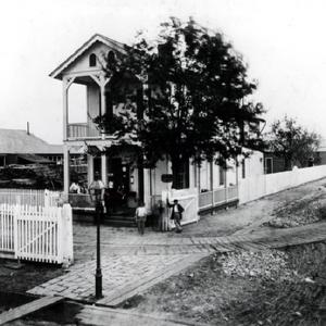
Though the Civil War was over, the practice of segregating New Orleans streetcars by race continued. This tour explores the actions of Joseph Guillaume and others in their efforts to integrate New Orleans streetcars during the Reconstruction Era.
Access: Online only
Tips: This tour is meant to be experienced virtually because many of the locations mentioned in each stop no longer exist. You can visit the site that all stories are pinned to at the corner of Canal and Rampart Streets, where…
Shadow Steeds of the Crescent City
10 Locations ~ Curated by Lacar Musgrove, University of New Orleans
Explore the history of New Orleans' early “penny farthing” cycling clubs and bicycle races on this bikeable tour covering the highwheel bicycle era, 1881-1891.
Access: Biking
Distance: ~12 miles, ~1-1.5 hours (includes all stops)
~6 miles, ~30-45 minutes (excludes final stops)
French Quarter Street Food
7 Locations ~ Curated by University of New Orleans
Enjoy a walking food tour through the streets of the French Quarter and make sure to grab a muffaletta or a po-boy, something cool to drink and take a bite into New Orleans history!
Some of New Orleans best-known foods originated as working class foods in or around the streets of the French Quarter. The Vieux Carre reflects the complexity and diversity of New Orleans’ 300-year history. The Mississippi River and the French Market served as an anchor for the neighborhood as well as a port of…
Hollywood South: Film Production and Movie-Going in New Orleans
11 Locations ~ Curated by The New Orleans Historical Team
This tour tells the stories of different moments in the formation and evolution of Hollywood South in New Orleans. Sites reveal the important people, films, theaters, and locations from the silent era to the present. New Orleans has become a major hub in the film production world. A city so infamous for its revelry and the disasters it has endured, its connections to the film industry has often been overlooked.
Access: Hybrid driving and walking
Distance: ~8.5 miles, ~45 minutes driving…
Lakefront Airport
6 Locations ~ Curated by Teresa Thessen
One of the world's most advanced airports when it opened in the 1930s, Lakefront Airport retains many of its landmark buildings and hangars.
Access: Hybrid driving and walking
Distance: ~.5 miles, ~5 minutes driving
Tips: The terminal building has a restaurant that serves brunch and lunch.
Upstairs Lounge Fire
5 Locations ~ Curated by University of New Orleans History Department
The 1973 arson attack at the Upstairs Lounge killed 32 people and was the largest massacre of LGBTQ individuals in the United States prior to the Pulse Nightclub shooting in 2016. The disgraceful reaction of the media and most New Orleanians galvanized the LGBT community as they mourned those lost to the deadliest fire in New Orleans history.
Access: Online only
Tips: This tour is meant to be experienced virtually because the building is not open to the public. However, a plaque dedicated to…
Jackson Barracks
10 Locations ~ Curated by Louisiana National Guard. Tour by Rhett Breerwood, LANG Historian
Jackson Barracks is a military post which has been a part of the New Orleans landscape since the first half of the 19th century. It has been through the Mexican War, the Civil War and Reconstruction, both World Wars and countless hurricanes and floods. Devastated by Hurricane Katrina, the post has undergone a massive rebuilding project and continues to be an important presence in the city and the state.
Access: Driving
Distance: ~1 mile, ~5 minutes to drive along Delery St
Tips: Jackson…
Palmer Park
7 Locations ~ Curated by Kevin McQueeny
A walking tour through the history of Palmer Park, located in the Carrollton neighborhood at the intersection of South Carrollton and Claiborne avenues. This tour exposes many connections to ongoing debates over the use of New Orleans’ public spaces.
Access: Walking
Distance:
Wedell-Williams Airport in Jefferson Parish
6 Locations ~ Curated by Teresa Thessen
James R. Wedell and Harry P. Williams founded the Wedell-Williams Air Service in Patterson, Louisiana, in 1929. The company expanded its transport routes as far as Dallas, Houston, and St. Louis. Wedell's aircraft designs brought the company fame via air races held across the country.
Access: Online only
Tips: The airport no longer exists. The tour stops are all attached to its former location.
Wedell-Williams Airport in Patterson
5 Locations ~ Curated by Teresa M. Thessen
James R. Wedell and Harry P. Williams established the Wedell-Williams Air Service in Patterson, Louisiana, in 1929. The company expanded its transport routes as far as Dallas, Houston, and St. Louis. Wedell's aircraft designs brought the company renown through air races held across the country. The renamed airport and its museum preserve Louisiana's aviation history.
Access: Driving
Distance:
200 Years of Louisiana Supreme Court History
11 Locations ~ Curated by Mary Ann Wegmann, The Law Library of Louisiana, University of New Orleans History Department; Edited by Jessica Anne Dauterive
2013 marked the 200th anniversary of the founding of the Louisiana Supreme Court. This tour features historic French Quarter sites, notable cases, and justices.
Access: Walking or biking
Distance: ~2 miles, ~45 minutes walking
55 in '58: Integrating the University of New Orleans
7 Locations ~ Curated by Becky Retz
This is an immersive tour following the path of the 55 black students who integrated the new Louisiana State University at New Orleans (now the University of New Orleans) campus in 1958, creating the Crescent City's first desegregated school.
Access: Public transit
Distance: ~4.5 miles, ~1 hour
Tips: This tour is meant to be experienced by bus and on foot, taking the same bus route that many Black students took to the UNO campus in 1958. The 55 bus costs $1.25 for a single ride (Updated…
Carville: The National Leprosarium
9 Locations ~ Curated by Elizabeth Schexnyder, Curator, National Hansen's Disease Museum
Listen to this nine stop audio tour as you drive through the Carville Historic District, site of leprosy (Hansen's disease) quarantine hospital and treatment center from 1894-1999.
This hospital-community was designed to be self-sustainable. Quarantine laws dictated the development of the site into separate staff and patient areas. The tour covers the original sugar plantation (Indian Camp), the State of Louisiana's development of the Louisiana Leper Home, Daughters of Charity (a Catholic…
The Battle of New Orleans
9 Locations ~ Curated by Mary Ann Wegmann, Louisiana State Museum, and the University of New Orleans History Department; Associate Editor & Media Editor: Jessica Anne Dauterive; military history research assistance: Rhett Breerwood
The Battle of New Orleans was fought between the British and American armies on January 8th, 1815. Under General Andrew Jackson, the American forces defeated the British in their attempt to take New Orleans.
Although the battle was fought downriver from the French Quarter in present day Chalmette, this walking tour highlights French Quarter sites and buildings connected to the Battle of New Orleans through fact as well as legend.
This tour was created in January 2015 during the 200th…
Gallatin Street: New Orleans' First Vice District
4 Locations ~ Curated by Jessica Anne Dauterive, Greg Lambousy, William Jones, Sean Simonson, Ellie Ginsburg
Gallatin Street, the two-block stretch near the Mississippi River now known as French Market Place, was once the center of vice in Antebellum New Orleans. This tour shares some of the stories that gave Gallatin Street its notorious reputation as "the place where Terpsichore and Bacchus ruled the hour."
Access: Walking
Distance: ~0.5 miles, 10-15 minutes
Streetcars of New Orleans
8 Locations ~ Curated by Michael Mizell-Nelson, Kevin McQueeney
Streetcars are an iconic image of New Orleans. Although only four streetcar lines still exist—St. Charles, Canal, Rampart, and Riverfront—they remain nostalgic vestiges of the city’s past, immortalized in Tennessee Williams A Streetcar Named Desire, and a number one item on tourist lists of things to do in the Crescent City.
From their origins in the 1830s as local railcars and horse or mule-drawn drawn cars, to its transition to electric powered streetcars in the 1890s, through the early…
Urban Slavery and Everyday Resistance
9 Locations ~ Curated by Curated by Kate Mason
Enslaved people were among the first to enter the French colony of New Orleans. Furthermore, they were instrumental to the creation of a successful city, building much of the infrastructure, acting as the first doctors, and cultivating early essential crops, like rice. During the antebellum era (1803-1861) 750,000 enslaved people were forcibly shipped south to New Orleans. This number doesn't include the many enslaved people who were illegally shipped from Caribbean islands or traded overland…
Writers' Blocks: Literary History in the French Quarter
7 Locations ~ Curated by UNO History Students
Produced in conjunction with the Tennessee Williams Festival, this tour takes you to the homes and haunts of famous literary figures in New Orleans history.
Access: Walking
Distance: ~1 mile, ~15–20 minutes
Removed Confederate Monuments in New Orleans
5 Locations ~ Curated by The New Orleans Historical Team
In the aftermath of the mass shooting at a Black church in Charleston in 2015, symbols associated with the Confederacy faced renewed scrutiny throughout the U.S. and calls for their removal became commonplace, as did public protests and anti-monument graffiti. For many New Orleans residents, monuments to prominent men of the Confederacy glorified slavery, racism, white supremacy, and oppression, and should no longer occupy prominent places within the city.
In 2015, pressed by these protests,…
The Birthplace of Jazz: A Walking Tour Through New Orleans' Musical Past
9 Locations ~ Curated by UNO Public History Grad Students, Prof. Charles Chamberlain
New Orleans' claim to be the birthplace of jazz is explored in this walking tour, which focuses on the musical artists and the communities where jazz developed in and around the French Quarter.
Starting with the discovery site of the Original Dixieland Jazz Band on Canal Street, the tour ventures to the Back of Town neighborhood of Louis Armstrong's youth to the vaudeville playhouses and dance halls of the Tango Belt and Storyville districts. In the Treme neighborhood, public artworks in…
Free People of Color and the Business of Survival in Antebellum New Orleans
6 Locations ~ Curated by Emily Clark, Kate Mason
When New Orleans became a part of the United States in 1804, the population of the French Quarter was 8,222 with 1,565 free people of color, just over 30% of the total free population. The free black population flourished throughout the Spanish era of the late 18th century only to face uncharted territory upon joining the United States in 1803 with the Louisiana Purchase. Despite increasingly strict regulation upon the lives of these men and women, they dug their heels into New Orleans society…
Modern Civil Rights in New Orleans
8 Locations ~ Curated by UNO Public History Department and Dr. Chamberlain
This tour focuses on New Orleans's role in the modern civil rights movement of the 1950s and 1960s. As one of the South's largest and most important cities, one with an African American protest tradition spanning generations, New Orleans was the center of activism as national civil rights groups, local churches, and college students organized to protest segregation through non-violent means.
Access: Biking or driving
Distance: ~8.5 miles, ~1 hour biking, ~30 minutes driving
Paper Monuments Project
44 Locations ~ Curated by PAPERMONUMENTS.ORG
Paper Monuments was a public art and public history project designed to elevate the voices of the people of New Orleans, as a critical process towards creating new narratives and symbols of our city that represent our collective vision, and to honor the erased histories of the people, places, movements, and events that have made up the past 300 years as we look to the future.
The removal of four Jim Crow monuments in the spring of 2017, the result of generations of organizing by Black New…
Oretha Castle Haley Boulevard: A Great American Main Street
8 Locations ~ Curated by Jennie Garcia, Dr. Michelle Thompson, with Adriana Bennett
Dryades Street, now known as Oretha Castle Haley Boulevard, was historically a thriving commercial center in New Orleans. Creole architect Barthelemy Lafon designed this street as a part of Coliseum Square in 1809. In January 1849, the City of New Orleans opened Dryades Market which helped create a flourishing commercial area with churches, banks, schools, services, and retail stores. By the 1860’s the street and community were known to be a “socially, morally, and religiously a desirable…
Gordon Plaza: Residents Fight for Fair and Just Relocation
7 Locations ~ Curated by The Midlo Center for New Orleans Studies at the University of New Orleans
In 1981, the City of New Orleans oversaw the construction of Gordon Plaza, an affordable housing development, on the former site of a major landfill. Almost since its construction, Gordon Plaza residents have raised concerns over contaminated soil and have sought a fully funded relocation to safer ground. This tour details negligent landfill operations, the construction of affordable housing targeted at low-income home buyers, and the on-going health complications residents endure as they fight…
A Space of Their Own Color: Black Greek Letter Organizations at UNO
6 Locations ~ Curated by August Darbonne
Located on the shores of Lake Pontchartrain, the University of New Orleans looks very much like a typical college campus. Yet the history behind this university is one of distinction, hostility, and resistance.
First opened in 1958 as the Louisiana State University in New Orleans, UNO had the distinction of being both the first public university in New Orleans and first public university to open as integrated. Yet despite its racially integrated student body, African American students at UNO…
Scenes from Krazy Kat's 'Infint-hood': The George Herriman Walking Tour
12 Locations ~ Curated by Michael Tisserand
Krazy Kat was an early 20th century newspaper comic strip drawn by New Orleanian George Herriman for 40 years. This tour explores Herriman's early years and background in New Orleans.
The childhood of famed “Krazy Kat” cartoonist George Herriman might be considered his missing years. For years, facts were elusive — and Herriman didn’t clear things up. The few public statements he made about his youth were in jest. Occasionally he said he was born in Los Angeles. Often he said he was the son…
The New Orleans Tribune: America’s First Black Daily Newspaper
9 Locations ~ Curated by Mark Charles Roudané
The New Orleans Tribune, or la Tribune de la Nouvelle Orléans, was America’s first Black daily newspaper. Created by free Black leaders, the Tribune was a formidable political tool that built a courageous campaign for social justice during the Civil War and Reconstruction eras. The paper’s primary mission, the right for all Black men to vote, resonated throughout the nation and demanded Lincoln’s attention. The Tribune agenda included redistribution of plantation land to the emancipated,…
Archaeology of Madame John's Legacy
4 Locations ~ Curated by D. Ryan Gray
Madame John’s Legacy, located at 628-632 Dumaine Street, is often considered one of the best surviving examples of French Colonial architecture in the French Quarter, even though the existing structure was built in 1788 during Spanish colonial rule. Over the years, the site has been the subject of three different formal archaeological excavations. This tour explores the findings of those excavations.
Access: Online only
Tips: Madame John's Legacy is closed for historic restoration (updated…
Archaeology of the Cabildo
2 Locations ~ Curated by D. Ryan Gray
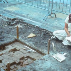
Today, the Cabildo is a facility of the Louisiana State Museum, but the courtyard of the Cabildo was the location of a city prison complex for nearly two hundred years, across French, Spanish, and American rule. Constructed in 1730, the prison and police station were some of the city’s earliest administrative structures. This tour explores artifacts uncovered during a 1988 archaeological dig and interprets their historical significance.
Access: Online only
Tips: This tour includes…
Ladies First: Women Activists Leading the Civil Rights Movement in New Orleans
7 Locations ~ Curated by Terri Rushing
This tour will explore how women and girls played a major role in challenging legislation that perpetuated racial segregation in New Orleans by explaining the experiences of each woman and girl, and events associated with each person and location. By organizing, protesting, marching, picketing, boycotting, and conducting administrative work, women and young girls successfully fought for Black equality and provided a framework for future generations of women to agitate for increased civil…
Trail of Crumbs: Tracing the Lore, Labor, and History of Bread-Making in New Orleans
6 Locations ~ Curated by Dana Logsdon
The cultural, social, and economic development of New Orleans -- from a colonial port to an American city -- can be traced through its history of bread baking. Bakers and millers were among the earliest laborers brought to the city by the French in the early eighteenth century. By 1820, there were close to sixty bakers in New Orleans, primarily French. A century later, the city directories listed over 200 bakeries, many under German, Italian, and Anglo-American names. Although rooted in a French…
Melpomene Street Blues: Archaeology of the Guste Homes in Central City
11 Locations ~ Curated by D. Ryan Gray, Rachel Breunlin, and Shana M. griffin
In 1961, the Housing Authority of New Orleans (HANO) demolished a portion of the Melpomene neighborhood in Central City to make way for The William J. Guste, Sr. Homes, a public housing project consisting of 993 public housing units including a 12-story high-rise, a building for elderly residents, and six low-rise buildings.
The Melpomene neighborhood looked much like the rest of the Central City area, with densely packed houses, corner stores, and other small businesses. When HANO…
The Thompson Sisters
3 Locations ~ Curated by Kalie A. Dutra & Kathryn O'Dwyer, Editor
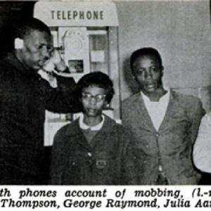
On September 22, 1961, the Interstate Commerce Commission (ICC) outlawed racial segregation on bus transit, requiring the removal of “whites only” signs by November 1 of that same year.
The ICC made this decision in response to the efforts of activism, protest, and arrests initiated by the Freedom Riders. Organized by Congress of Racial Equality (CORE), the Freedom Riders planned bus trips that facilitated an upheaval of long-standing white supremacy throughout the segregated South.
The…
No Sugar-Coating: The Plantation History of Audubon Park
6 Locations ~ Curated by Taylor Lindner, Kalie A. Dutra, & edited by Kathryn O'Dwyer
During the late eighteenth and early nineteenth centuries, the land that is now Audubon Park was the Boré Plantation and the Foucher Plantation. Popular histories often credit Étienne de Boré, an enslaver and the first mayor of New Orleans, with establishing the sugar industry in southern Louisiana. This historical narrative ignores the grueling and deadly work that the sugar industry required of enslaved people. This tour reframes Boré’s contributions to the sugar industry and centers the work…
Streets on the Table
7 Locations ~ Curated by The New Orleans Historical Team
Produced by the Midlo Center for New Orleans Studies, Streets on the Table is a podcast that reflects on the historical relevance of both the old and new street names in New Orleans. Hosted by two UNO graduate students, the podcast highlights the lives and histories unrecognized in the commemorative landscape.
Access: Online only
Tips: This tour is meant to be experienced virtually, with each tour stop containing a podcast episode that corresponds to a map point. Along with images, the…
Plessy v. Ferguson: The Fight for Civil Rights in New Orleans
7 Locations ~ Curated by Plessy & Ferguson Initiative with UNO student collaborators
Created by UNO students in collaboration with the Plessy and Ferguson Foundation, this tour dives into the origins of the Plessy v. Ferguson case and highlights the civil rights activism in New Orleans that launched the broader national movement for civil rights in the U.S.
Access: Biking or driving
Distance: ~7.5 miles, ~1 hour biking, 40 minutes driving
Tips: Tour order is based on chronological and narrative flow, but can be adjusted for ease of biking
Frenchmen Notes: The Making of a Music Scene
9 Locations ~ Curated by Hannah Kreiger-Benson and Laura DeFazio, Edited by Jessica Dauterive
Created by Hannah Kreiger-Benson and Laura DeFazio, founders of the Frenchmen Notes project, this tour tells the story of Frenchmen Street through the voices of those who helped to develop its sounds and scene.
Access: Walking
Distance: