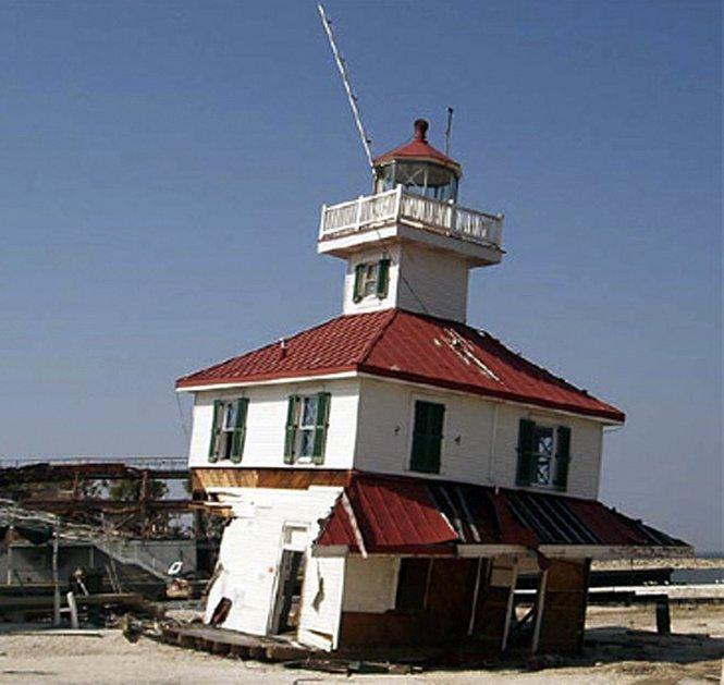
New Canal Lighthouse
Text
In the 1830s, Irish and German immigrants dug the New Basin Canal as a link between New Orleans and Lake Pontchartrain. The lake end of the canal featured the New Canal Lighthouse, originally an octagonal, wooden tower resting on pilings driven into the lake bottom. Built by Francis D. Gott in 1838 for $4,500, the tower's lower timbers rotted within four years, causing it to lean.
Originally, the lighthouse stood approximately 1,000 feet offshore. Landfill projects in the early 1900s slowly brought the shore closer to the lighthouse, creating what is now Lakefront Drive. After the original lighthouse was torn down, a second square-shaped, one-story iron piling was completed in 1855.
During the American Civil War, the Confederate forces kept the lighthouse active until New Orleans fell to Union forces in April 1862.
The lighthouse remained active from the end of the Civil War in 1865 until August 2005, when Hurricane Katrina damaged the lighthouse beyond repair. In 2007, the Lake Pontchartrain Basin Foundation dismantled the remains and salvaged as many historic materials as possible.
The lighthouse re-opened in 2013 as the New Canal Lighthouse Museum and Education Center. The lighthouse contains exhibits on the history, ecology, and preservation of the lake and lighthouse, as well as views of the lake from the outdoor deck. At night, the lighthouse's beacon is still in operation to guide boats passing through the lake.
Metadata
Relation
Files
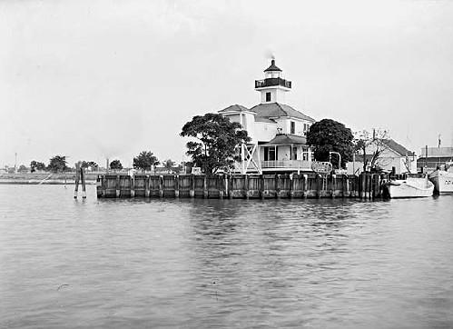
New Basin Lighthouse, 1950s
In 1834, a lighthouse costing $25,000 was built to mark the entrance to the New Basin harbor. It began operating in 1838, but was listed as unrepairable by 1854. In 1855, it was rebuilt as a fifth order light on the keeper's dwelling at a cost of $6,000. In 1890, the lighthouse was discontinued, sold at auction, and torn down. A lantern hung from a pole in its place. In 1901, this more familiar structure was erected on iron pilings with a fifth order lens. The lighthouse was moved to its present location circa 1910. The exterior was restored in 1976. Courtesy of Louisiana Division/City Archives, New Orleans Public Library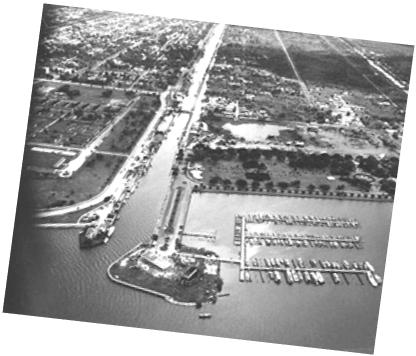
New Basin Canal and West End, early 1950s
Aerial photograph includes the US Coast Guard Station (lower middle), First Canal Lighthouse (lower left), and the Southern Yacht Club (foreground). LaGarde Hospital is visible in the upper left hand corner. This image captured the New Basin Canal before the once essential, commercial waterway was mostly filled in during the 1950's to create the Pontchartrain Expressway & West End Boulevard. Courtesy of Louisiana Division/City Archives, New Orleans Public Library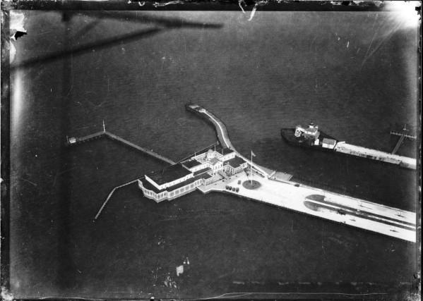
Aerial view of West End, circa 1940s
The Southern Yacht Club building is featured at the center of this aerial view. This building also was destroyed by Hurricane Katrina in 2005, and a new structure now stands on this site. The New Basin Lighthouse is located on the opposite side of the canal. Courtesy of Louisiana Division/City Archives, New Orleans Public Library